History of balaghat
At the beginning of the 18th century, the district was divided among two Gond kingdoms; the portion of the district west of the Wainganga was part of the Gond kingdom of Deogarh, while the eastern portion was part of the Garha-Mandla kingdom.

The Deogarh kingdom was annexed by the Bhonsle Marathas of Nagpur in 1743, and shortly thereafter conquered all but the northern section of the district. This section, together with the rest of the Garha-Mandla kingdom, was annexed in 1781 to the Maratha province of Saugor, then under control of the Maratha Peshwa. In 1798 the Bhonsles also obtained the former Garha-Mandla territories.
In 1818, at the conclusion of the Third Anglo-Maratha War, The Nagpur kingdom became a princely state of British India. In 1853, the Nagpur kingdom, including Balaghat District, was annexed by the British, and became the new province of Nagpur. Balaghat District was then divided among the British districts of Seoni and Bhandara. Nagpur Province was reorganized into the Central Provinces in 1861.
Balaghat District was constituted during the years 1867 by amalgamation of parts of the Bhandara, Mandla and Seoni districts. The headquarters of the district was originally called “Burha”. Later, however, this name fell into disuse and was replaced by “Balaghat”, which was originally the name of the district only. Administratively, the district was divided into only two tehsils, Baihar tehsil in the north, which included the plateau region, and Balaghat tehsil in south, which included the more settled lowlands in the south. The new district was part of the Central Provinces’ Nagpur Division.
In the middle of the 19th century, the upper part of the district was a lightly settled, And a beautiful Buddhist temple of cut stone, belonging to some remote period, is suggestive of a civilization which had disappeared before historic times.The first deputy-commissioner of the district, Colonel Bloomfield is believed as the pioneer or the Creator of Balaghat District whom encouraged the settlement of Baihar tehsil with Panwar Rajput from the Wainganga Valley. About that time one Lachhman Panwar established the first villages on the Paraswara plateau.Malanjkhand is the most popular copper mine in Asian Region.
In 1868-1869 the rains ceased a month before time, causing the failure of the lowland rice crop and a famine. The district suffered very severely from the famine of 1896-1897,when the output of all crops fell to only 17 percent of normal. The district suffered again in 1899-1900, when the rice crop failed again, falling to only 23 percent of normal. The population in 1901 was 326,521, having decreased 15% in the decade 1891-1901, due to the effects of famine.
At the beginning of the 20th century, the district had only 15 miles (24 km) of paved roads, together with 208 miles (335 km) of unpaved roads. The Jabalpur-Gondia railway line through the district was completed in 1904, with six stations in the district.
After Indian Independence in 1947, the Central Provinces became the Indian state of Madhya Pradesh. In 1956, Balaghat District became part of the Jabalpur Division of Madhya Pradesh, when the districts to the south of Balaghat, including Gondia, Bhandara, and Nagpur districts, were transferred to Bombay State.
Balaghat District is currently a part of the Red Corridor. Balaghat district was constituted during the years 1867–1873 by amalgamation of parts of the Bhandara, Mandia, and Seoni Districts. Its name signifies “above the ghats” and is due to the fact that the original purpose of Government in constituting the District was to effect the colonization of the tracts above the ghats.The headquarters of the District was originally called Burha . Later, however, this name fell into disuse and was replaced by ‘Balaghat’ which was originally the name of the District only.
In MP Balaghat district has much natural beauty, mineral deposits and also prosperous with forests. There are too many stories told for the nomination of Balaghat. BUDHA, this name is given by the historians of 1743–1751 time period. Balaghat comes under the Bhandara dist. Raghuji is the first Maratha who came to this place from Kirnapur Side.
In 1845, DALHOUSIE started the tradition of adoption . Through this tradition states of the GOND emperors were added to the BRITISH states, at that time the actual name of this place was BARAHGHAT. For the fixing of this name the name a proposal was sent to the capital of that time Calcutta before 1911.
The name Barahghat drives because all the names of hills contain the word ghat, In which Masen Ghat, Kanjai Ghat, Ranrama Ghat, Basa Ghat, Dongri Ghat, Selan Ghat, Bhaisana Ghat, Saletekri Ghat, Dongaria Ghat, Kavahrgarh ghat, Ahmadpur ghat, Teepagarh Ghat are important. When this word was sent to Calcutta it merged with ANGL word and the name was Baraghat. When this was returned from there the name changed “L” as Balaghat means in the position of “R” which was permitted. and the District got its name as Balaghat. On 1 November 1956 it was declared as Independent District of newly created State of Madhya Pradesh.
About balaghat district
Balaghat is a city and a municipality in Balaghat district in the state of Madhya Pradesh, India. It is the administrative headquarters of Balaghat District. The town was originally called “Burha” , but this name was replaced by “Balaghat”, which was originally the name of the district only. Balaghat means “above the ghats or passes.” In bollywood, there are two gems which are from balaghat.Firstly, Mushtaq khan a television actor,they are from baihar tehsil of balaghat.Secondly, Anil mange a television actor,they are from properly balaghat city.
QUICK 10 FACT’S ABOUT BALAGHAT
- Total no of police station – 22
- Total Area – 9245 Sq. Km.
- Tatall population – Population: 17,01,698
- Total no of male – 8,42,178
- Total no of female – 8,59,520
- Language: 1)Hindi (Primary)2)English (Additional) (Gondi language primary language for schedule tribes people’s ) Pawari language (caste language of parmar’s people) Chattisgarhi language (speaking in northeastern part of balaghat) Marathi language (speaking in south part of balaghat)
- Janpad Panchayat: 10
- Population Density – 3,400/km2 (8,700/sq mi)
- Pin code – 481001
- Vehicle registration – MP-50
11 best tourist places in Balaghat
1. Kanha National Park, Balaghat

Kanha Tiger Reserve, also called Kanha National Park, is one of the tiger reserves of India and the largest national park of Madhya Pradesh, state in the heart of India. The present-day Kanha area is divided into two sanctuaries, Hallon and Banjar, of 250 and 300 km2 respectively. Kanha National Park was created on 1 June 1955 and in 1973 was made the Kanha Tiger Reserve. Today it stretches over an area of 940 km2 in the two districts Mandla and Balaghat.
The park has a significant population of the Royal Bengal tiger, Indian leopards, the sloth bear, barasingha and Indian wild dog. The forest depicted in the famous novel by Rudyard Kipling, The Jungle Book is based on jungles including this reserve. It is also the first tiger reserve in India to officially introduce a mascot, “Bhoorsingh the Barasingha”
Kanha National Park
Kanha Tiger Reserve is home to over 1000 species of flowering plants.The lowland forest is a mixture of sal and other mixed-forest trees, interspersed with meadows. The highland forests are tropical moist, dry deciduous type and of a completely different nature from bamboo on slopes. A notable Indian ghost tree can also be seen in the dense forest.
Kanha Tiger Reserve has species of tigers, leopards, wild dogs, wild cats, foxes and jackals. Among the deer species, swamp deer or hard-ground barasingha is the pride of the place, as it is the only subspecies of swamp deer in India, except the great swamp deer of Sundarbans. The animal is adapted to hard ground unlike swamp deer of the north, which live in marshy swamps.
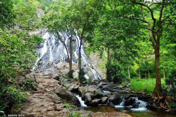
2. Gangulpara Dam and Waterfall, Balaghat

The Gangulpara Tank and Waterfall is located in the Balaghat district of the central Indian state of Madhya Pradesh. It is at a distance of 14 kilometers from Balaghat. One can discover this waterfall on the Baihar road. It is a marvelous mixture of natural beauty and splendor, feasting the eyes of the onlooker! An ideal picnic spot for the locals, it is frequently visited by them for their weekend getaways.
Nature lovers appreciate this water body, which also serves as a storage tank for the waters of Ghysri Nala. This water reserve fulfills the irrigation needs of the farmers of the local village nearby, Tekadi.
Gangulpara Dam Is surrounded by lots of hills and in between this tank is looked like a natural water tank.you can also see gangulpara dam when passing through 52 ghat which is surrounded by this dam.in the rainy session this place is very beautiful and natural little falls are flown every where.
3. Malanjkhand Copper Project, Balaghat

Malanjkhand Copper Project (MCP) at Malanjkhand, Madhya Pradesh
Malanjkhand Copper Belt comprises of a large body of copper ore in granitic rocks varying from diorite to granite in composition. Prominent deposits are: Malanjkhand, Shitalpani (Balaghat, Madhya Pradesh), Gidhri Dhorli, Jatta and Garhi Dongri
Malanjkhand Copper Project was established in 1982.Initial project has been set up by Hindustan Copper Ltd to exploit the copper ore through an open pit mine. Geological Survey of India took systematic geological exploration at this deposit during 1969. Mining lease of the ore was granted to HCL during 1973. With advancement of time this project was enhanced with viable operational developments.
At present besides the open pit mine and concentrator plant the project has also been provided with auxiliary facilities such as Tailings Disposal and Water Reclamation System, Repair Shops, Maintenance Garage, Water Treatment Plant, Warehouses, Fuelling Stations, 132 KV Power Sub-station, Waste Treatment Facilities and Township with modern amenities.
4. Bajarang Ghat , Balaghat

Bajarang Ghat is a dream come true for nature lovers swimmers who dont like shallowness and restriction of the city swimming pool. one can approch this beautiful ghatthrough various routes including one passes through the Forest Rangers College Balaghat.”Bajarang Ghat” has small tempels and “Akharas” and has a quite safe ghat with very gradually increasing depth thus making it an ideal “Natural Swimming Pool”.this Ghat witnesses a large crowd in the summer season.the other side of the ghat called as “jalaj” is the tip of a big submerged rock and serves as a resting place for the accomplished swimmers who can cross the river to reach it.there is also a local swimmers club located here which is known as the jila tairaki sangh balaghat.this ghat is on wainganga river.
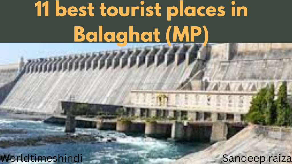
5. Rajiv Sagar Dam , Balaghat

Rajiv Sagar dam project built by Madhya Pradesh (MP) and Maharashtra government is expected to benefit 97 villages of Balaghat district of MP: Agricultural produce and financial conditions of farmers likely to improve. The Rajiv Sagar (Bavanthadi Dame) large project built on the Baavanathadi river is an inter-state project in Madhya Pradesh and Maharashtra. The project has been constructed on the Baavanathdi village near Tahasil Tumsar of Bhandara district in the village Kudva of Tehsil Katagi of Balaghat district and the Bhandara district of Maharashtra. The dam here is built 31 meters high and 6 kilometers 420 meters long.
6. Rampayli Temple , Balaghat

It is said that Lord Rama was in the footsteps of 14 years of exile, since then the name of this city has become Ram Pavdali, ie Ram Paiyali. According to the local people, the construction of Sri Ram temple was done 600 years ago by Maratha Bhonsle in a scientific manner as a fort on the river banks.Such a place has been constructed in the temple, from which the first ray of sun falls at the feet of Lord Ram Balaji. The construction of this temple is mentioned in the ancient history of India.
The main Siddha Murthy of Shri Ram Mandir is Balaji and Sitaji. The idol of Lord Rama is in the forested form. The left hand of Ram Dev is seeing the Virat monsters and giving them blessings on the head of the fearful Sita. Those devotees give direct views of Sriram and Sita.
This statue of Lord Rama’s Vanvasi costume was received from the depth of the Chandan river, about four hundred years ago, when a person was seen in the dream. The statue was removed and placed under the Neem tree on the river teak and King Bhosale renovated the temple and established the idol.
7. Dhuty Dam , Balaghat

Dhuty Dam, officially the Dhuti Weir, is a diversion head work over Wainganga River near Lamta in Balaghat district of the Indian state of Madhya Pradesh. The dam was built in 1923 under the supervision of the British civil engineer Sir George Moss Harriot.There are two canals on the sides of the dam. The canal on the eastern side provides irrigation to Lamta, the one on the western side to Lalbarra.
8. Nahlesara Dam, Ashoknagar

Located about 58 km from Balaghat, Nahlesara is an old dam that serves the irrigation purpose of the nearby villages. It was built during 1960-1965. Constructed on the Chandan River, the dam is about 2 km long. The surrounding places of the Nahlesara Dam are ideal for holidaying. Amma Mai Temple, situated at a distance of 1 km behind the dam, is another point of attraction.
9. Lanji Fort , Balaghat

The present fort of Lanji is very ancient from Great King Sangram Shah’s 52 bastions.Presently the castle remains in the fort, the princess Haldas’s grandfather Malukuma built in the 12th century. The fort has been constructed in a total of 7 acres of land. The main entrance of the fort is oriented towards the center of which is symbol of the tortoise and the sign of the snake. The fortress of the fort is Chatusonian, whose height is about 20 feet, four bourges were constructed on four corners, out of which two burzes are still safe. The width of the walls of Paracotas is 8 feet, which is also the route from one Burj to the other.
There is a deep trench on the four sides of the Pakkota, which was said to have filled the water in the trench, in which large crocodiles were fished, the crocodile swam and fired the enemies coming in the fort. Thus, the fort of Lanji was a staunch castle from a security point of view. The texture of the fortress of the fort is similar to the fort of Chandgarh, on the Parakota and Burj, the peasants and peasants of Ficus religiosa and Banyan have grown, whose age is 300 years old. After entering the main entrance of the fort, the remains of construction work on the left are seen where the palace was situated. In front of it is a bath on the west side whichis covered with soil now.
10. Gomji-Somji Temple , Balaghat

Gomji-Somji Temple with a sister temple known as jwaladevi temple, located on the peak of Bharveli region’s mountains and around 10km far from Balaghat is one of the places of religious importance in the region. Jwaladevi attracts thousands of piligrims from MP and Maharashtra every year, specially during Navratri Festival. Navratri festival celebrations at this temple attract thousands of devotees from across the state of Madhya Pradesh.
11. Maa Kaalipath Temple, Balaghat

Maa Kaalipath Temple is located in Forest Colony in Balaghat district, it is beautifully seen by the beauty of this temple. According to the local people, there is a belief that the statue of Mata had left itself out of the earth, at that time only a part of this statue was seen. According to the people, the idol is coming above the earth day by day, due to this, today the whole part of the idol has come out of the earth, but according to the belief, no definite shape of the statue is known to anyone, how far the idol is within. Every year, during the Navaratri festival, a large crowd of devotees gather for this philosophy. Thousands of people come from Balaghat and its surroundings every year. This is a proven goddess place for the people of Balaghat.
How to Reach
By Air
Birwa Aerodrome is nearest way to reach Balaghat.Birwa is a Village in Baihar Tehsil in Balaghat District of Madhya Pradesh State, India. It belongs to Jabalpur Division . It is located 55 KM towards East from District head quarters Balaghat. 2 KM from Baihar. 410 KM from State capital Bhopal
By Rail
Balaghat Railway Station is situated on the Jabalpur-Nainpur-Gondia section of South East Central Railway, in the Indianstate of Madhya Pradesh. Rail routes through the junction include routes towards Jabalpur, Gondia, Katangi on the Satpura Railway. There is/are 2 direct train(s) from Jabalpur to Balaghat. The minimum time a train takes to reach Balaghat from Jabalpur is 5h 27m.
By Road
You can easily get regular buses to Balaghat from other major cities of the country
Where To Stay
Jhulelal Dharamsala
Address: 19, Sindhi Colony, Sindhi Mohalla, Chitragupt Nagar Sindhi Mohalla, Chitragupt Nagar Balaghat, Madhya Pradesh Pincode: 481001
Phone:7050598936 Email:jhulelaldharamsalabgt@gmail.com
Sujan Dharamshala
Address: Chitragupta Nagar, Balaghat, Madhya Pradesh Pincode: 481001
Phone:07632-240407 Email:chandrabhanmanglani@gmail.com


